
The Anglo-Scottish War 1482
The Dumfries Raid
by Sandra Pendlington
In May 1482 Richard led a large raiding party into Dumfriesshire. Dumfriesshire was a rural county with the Solway Firth to the south and hills to the north. Many swift flowing rivers crisscrossed the area, flowing down from the hills to the Solway Firth. There were few roads and the county was sparsely populated. Its county town was the Royal Burgh of Dumfries situated on the east bank of the River Nith, ten miles north of the Nith estuary and the Solway Firth. The Royal Burgh of Annan, once home to the Bruce family, the lords of Annandale, was the second largest settlement in the county.

The Dumfriesshire Raid
In 1482 the county was far from peaceful. The few settlements were close to castles and the many towers were situated at critical fords across the rivers. They provided protection for the people in times of danger. The largest fortification in the county was Lochmaben Castle in Annandale, which was surrendered by a defensive network of towers.
Towers were held by the ‘graynes’ – local warring families who became better known as the reivers in the 16th century. The Johnstons at Lockwood Tower near Moffat and the Bells at Bells Tower in Annandale, the Littles at Meikledale Tower in Liddesdale and the Maxwells at Caerlaverock Castle near Dumfries raided Cumberland and fought with each other.
The Kirkpatrick of Closeburn book describes the Dumfriesshire towers as ‘built with more regard to security than comfort…large square battlemented towers, with walls of immense thickness, built without any opening on the ground floor and entered by a moveable ladder.’ On approaching Lockwood Tower, James V exclaimed, ‘He who built it must have been a knave at heart.’ Beacons were situated across the county to warn people that they should seek safety.
In western Dumfriesshire the border between Scotland and England was in the middle of the Solway Firth and in 1482 it was the international border between two countries who were at war. In eastern Dumfriesshire there was no defined border. East of the river Sark in an area where the Esk and Liddelwater flowed was an area of dispute called the Debatable Lands, where rule of law did not apply and thieving and thuggery were commonplace. It was from here that the Scottish graynes crossed into England to wreak havoc during the winter of 1481-82.
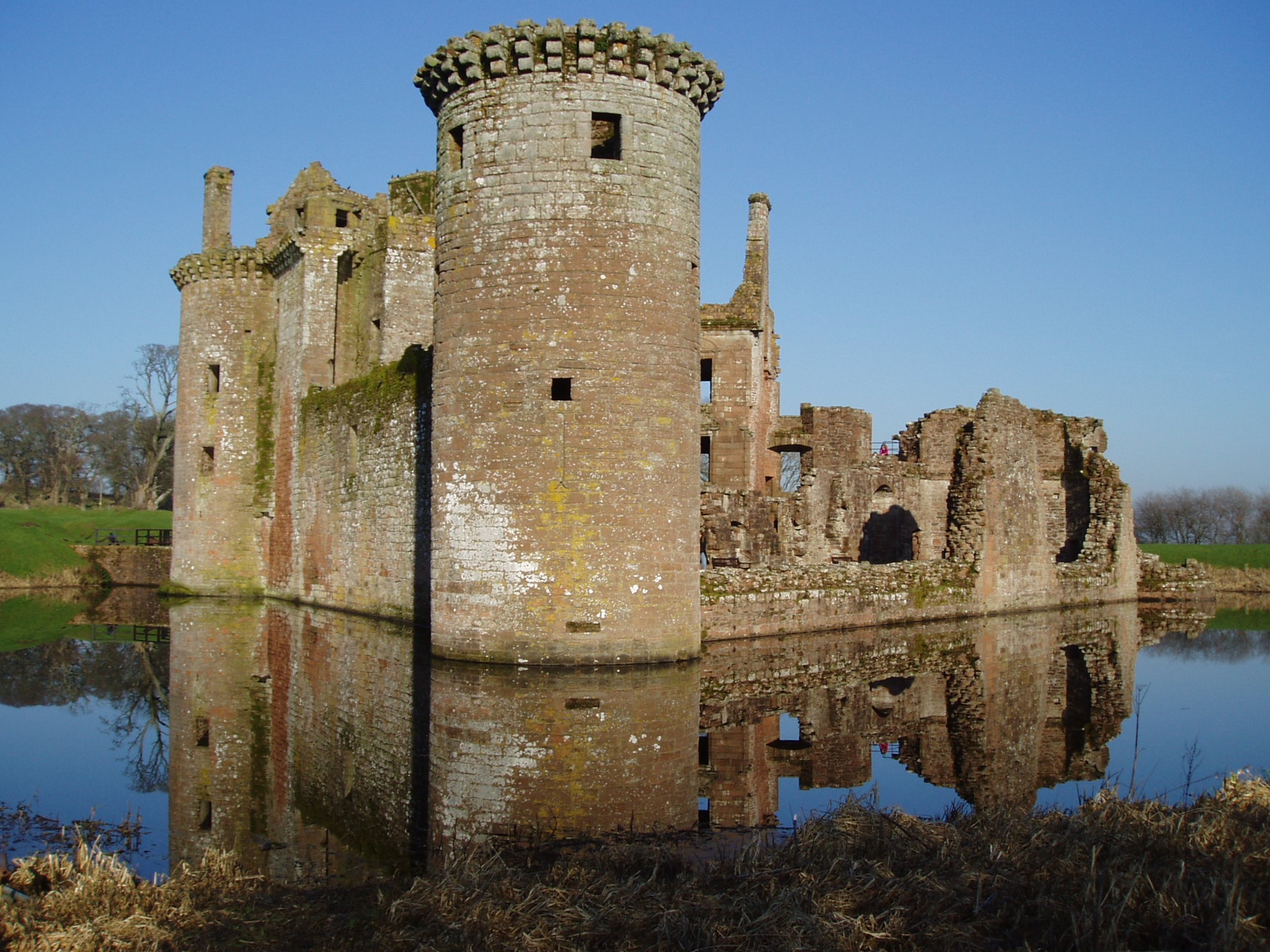
Caerlaverock Castle, Dumfriesshire (S Pendlington)
Dumfriesshire Prepares
The Scots and English had been at war since 1480 and by spring of 1482 the Scots were expecting an invasion. The Scottish Parliament met in March 1482 and passed acts to increase resistance in the Border area. Orders were given for men to be posted every 6 miles along the Scottish coast. This would have applied to the Solway coast in Dumfriesshire. Lords were ordered to stock up with food and essential supplies. The Wardens of the Marches were ordered to resist any invasion in their area.
Four strongholds in Lower Annandale are mentioned by name and together they were sent 200 reinforcements. Lochmaben Castle was sent 100, Castlemilk near Lockerbie (see research note 1) and Annan Castle received 40 men each and Bell’s Tower, near Eaglesfield, received 20. Half were spearmen, the other half bowmen. Sir Thomas Kirkpatrick, Laird of Closeburn, was appointed captain of Lochmaben Castle and Robert Charteris, Laird of Amisfield as his second in command, probably as captain at Annan Castle. Both lairds held castles in Nithsdale, north of Dumfries. Kirkpatrick was responsible for choosing the 200 men and two other deputies for Castlemilk and Bell’s Tower. He was also responsible for paying the men. The record says that spearmen received 2s 6d and the bowmen 2s, as payment for their service to the king.
So by the time the raid happened, the Scots had manned four strongholds at strategic positions across Lower Annandale.
Both Annan and Lochmaben Castles were built by the Bruces. Annan Castle was built first in the 12th century but its situation near the river meant it was liable to flooding, as well as being close to the coast and vulnerable to attacks across the Solway. The Bruces then built the larger more palatial Lochmaben Castle a few miles inland. Annan Castle continued to be manned but was no longer a residence.
In 1482 Lochmaben was a mighty stronghold and a residence of the Warden of the Scottish West March but little remains of the Castle now. Annan Castle was destroyed in an English raid in Tudor times and only the motte remains. Castlemilk and Bell’s Tower were smaller defensive structures guarding fords on Water of Milk and Kirtlewater. There are no traces of either tower today.
The strengthening of Annandale indicates the Scots were expecting the English to cross into Annandale and attack there. There is no mention of any fortification west or east of Annandale and all four fortifications mentioned are no more than 15 miles from the Solway Firth. There is no mention of Dumfries, which lacked defences after its castle had been destroyed in the 1300s, nor is there any mention of towers being reinforced in the debatable lands. However, Hermitage Castle, north of Liddesdale in Roxburghshire was included. Sir William Baillie, 4th Laird of Lamington, was appointed as captain of Hermitage Castle. He was ordered to choose 100 men to be ready to support both the Middle and West Marches if the English invaded.
The Solway Firth
To attack Dumfries it was necessary to cross the Solway, the long sea firth that separates Scotland and England. Dumfriesshire is at the eastern end of the Firth where the Solway is narrowest, but its narrowness does not mean that it was an easy crossing. On the contrary it was a formidable barrier even at low tide – rivers and treacherous mud flats must be negotiated. The incoming tides are fast and at high tide the water fills the whole width. However at low tide the Solway can be crossed using three traditional crossing places called waths. The most westerly is the Bowness Wath just before the River Annan flows in the Solway south of the Royal Borough of Annan. West of that the Solway is not passable for horsemen. At 1 mile 176 yards in length, it is the shortest crossing of the Firth proper and was used by both William Wallace and Edward I during the Scottish Wars of Independence. In 1482, Richard and his men almost certainly crossed the Solway on the Bowness Wath, which was the nearest to Dumfries town.
The photograph shows the Solway Firth looking north from Bowness. The hamlet on the Scottish shore is Back of the Hill. On the left is the water tower, which was the site of the Scottish beacon in 1482.
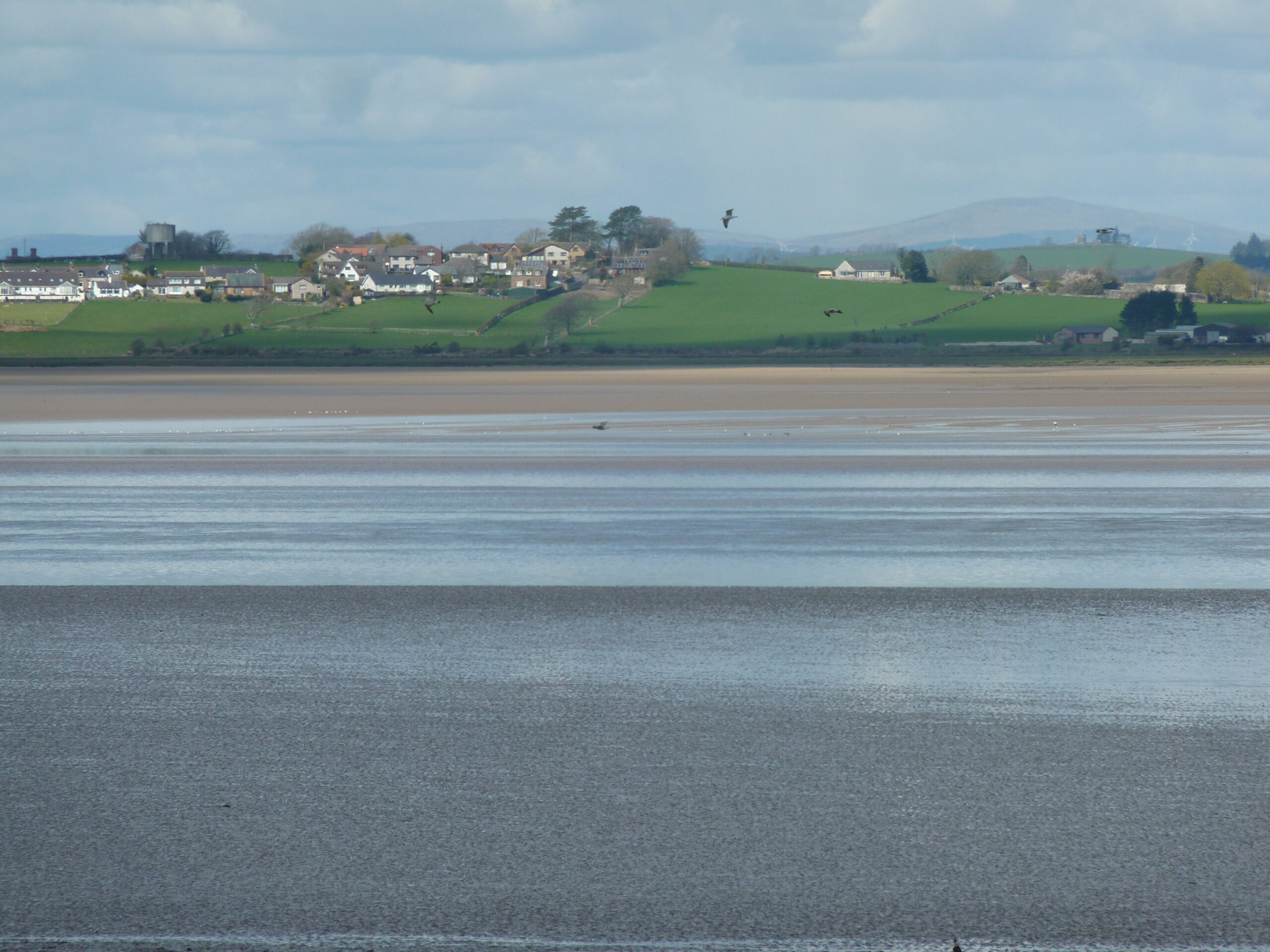
The Solway Firth from Bowness (S Scott Buccleuch)
Why did Richard attack Dumfries?
The devastation caused by the Scots during the previous winter needed a large-scale raid in response. Crossing the Solway Firth needed good weather, low tides and longer daylight – May would be a suitable month. Richard may have intended a much larger raid similar to the reprisal in Berwickshire and Roxburghshire in August 1480 but events in the South of England were changing the course of the war and this meant that Richard was needed in the south. In April, Alexander, Duke of Albany, the younger brother of James III, King of Scots, had landed in England from France. Discussions between him and Edward IV led to a new plan. The English army would be used to make Albany King of Scots, under Edward IV, and Albany would accompany the army north. Richard was present when the Treaty of Fotheringhay was signed at Fotheringhay Castle in early June (the full story is told in part 3). Therefore, Richard had little time to punish the Scots for their raids so declined on a speedy attack on the main town in Dumfriesshire – Dumfries.
How do we know when and where the raid happened?
The York records for Tuesday, 14th May 1482 give details of a letter received from Richard. Richard wrote that he ‘intends in his own person to enter Scotland upon Wednesday next’. He asked for men to accompany him. The York councillors agreed to send men ‘well and defensibly arrayed’ and appointed John Brackenbury as captain. Brackenbury took with him a letter from the mayor for Richard asking that the people of York should not have to bear the cost of their men’s service. Since there is no way the men of York could reach the border by the following day, the date for the raid must have been the following Wednesday – 22nd May. This request would have been duplicated throughout North Yorkshire and the West March.
On 29th May, the York records show that John Brackenbury and his men had returned, probably a day or two before. Brackenbury brought a letter from Richard thanking the councillors for sending him 80 able men, ‘well arrayed and horsed attending upon his grace at this last viage into Scotland’ and he sent their expenses so the charge would not fall on the people of York. No casualties were recorded. This confirms that the men of York reached Richard in time to go on the raid. The date for the start of the raid was 22nd May and exactly one week later the men of York had returned. These records confirm that the raid was a quick strike lasting no more than a day or two and not a sustained campaign (see research note 2).
There are two records that confirm that Dumfries was the target for the raid in May 1482.The first is part of a speech made in York by Richard III when he visited York and relieved tolls on the city. It was recorded in the York Council Records on 17th September 1483. Richard recalls the help he received from the city in the past.
‘Our sovereign lord the King of his most special good grace, remembering the good service that the said city has done to his good grace, first in the journey made to Dumfries and also in the journey late made to Edinburgh, and also in the late journey made to London to the coronation of his good grace…’ (York House Books, Vol 2, page 729).
The second is in a letter written by a merchant, George Cely, from Calais to Prior Weston in Naples giving him news of events in England. Among the items of news, he mentions Albany’s visit to England and gives some information about the invasion of southeast Scotland that took place in July-August 1482. He also says that Dumfries was burnt.
‘Pleaseth it your lordship to understand that the Duke of Albany is comen into England, and he is sworn to the King’s good grace, and the King has sent him into Scotland with 60,000 men in 3 battles, and many lords of England with him, Jesu be his good speed with them and many. There has been about 44 towns and villages burnt in Scotland, and many lords taken and slain; Dounfryss is burnt.’
Together the two references tell us that the raid in May 1482 was against Dumfries. However, there is disagreement about the meaning of Cely’s letter. How much of the reference applies to the Dumfries raid and how much to the forthcoming large invasion of southeast Scotland in July? Were the 44 other towns and villages in Dumfriesshire or in the invasion area? Were the Lords slain during the Dumfriesshire raid or during the July invasion? Research note 3 assesses these questions in detail and this assessment of the Cely quote indicates that Richard and his men burnt Dumfries and returned to Carlisle and that the rest of the quote refers to the main invasion.
The Raid Begins
As well ats the 80 men from York, Richard’s own men from North Yorkshire and the West March in Cumberland would have ridden with him. As many as 1000 men could have been involved. The men would have been dressed for swift riding in thick leather jerkins, leather trousers and helmets with their weapons strapped to their saddles. Their muster point would have been Carlisle. Leaving there on the 21st May, they rode to Bowness and camped out of sight of the Scots.
At first light and low tide, Richard and his men gathered on the southern shore of the Solway at Bowness. The men, led by local guides on foot, would have moved silently onto the wath in a narrow column. They could not rush – the guides had to watch for dangerous pools and quicksand. Stuart Thomson MBE, the historian for the Annan Common Ridings, has confirmed that at low tide it would have been possible for Richard and his men to cross the Solway and ford the River Annan.
The photograph taken from Annan Hill shows the Bowness Wath on the right of the wind-blown trees in the centre of the picture. The Scots had a system of warning beacons strung across the entire border with England. In the West, the town of Dumfries and surrounding settlements needed to be warned if the English were crossing the Solway. The beacons were rated 1, 2 and 3 depending on how big the raid was. This raid in 1482 would have been top rated. There were several beacons along the Solway, including a beacon on Annan Hill that overlooked the Bowness Wath. That beacon was visible from the top of Criffel, the hill that guards Dumfries. The photograph shows the water were the beacon was sited. Criffel can be seen in the distance on the left of the picture.
As the skies lightened, the men at the beacons would be wide awake. The men at Annan Hill would have been watching the Solway and those on Criffel would have been watching for the Annan Beacon to go up. Beacons around Dumfriesshire were ready to transmit the warning around the county.
On that morning in May 1482, the Scots stationed at the beacon on Annan Hill would have seen the long line of horsemen on the wath and would have fired the beacon, piling on wood to make the fire burn higher to indicate that this was a large raid. 18 miles away, men stationed at the Criffel beacon would have seen the beacon and lit theirs to let Dumfries and the surrounding area know that the English were coming. ‘Leave your home, take your animals and flee to the hills or tower’ was the message. Dumfriesshire’s settlements and landscape emptied of people.
This was particularly true in Lower Annandale where the English were expected to burn and destroy but instead Richard and his men rode west along the shore and crossed the River Annan away from Annan town and its castle. The photograph shows the River Annan flowing into the Solway. At low tide it appears to be a small stream. At high tide it is a significant river estuary, both deep and wide.
The photograph shows the approximate place where the raiders would have crossed the Annan, out of range of the castle. The bridge was built in 1826 and replaced an earlier one. It is not known whether there was a bridge in 1482. The remains of Annan Castle are on the bank of the river, to the left of the Town Hall spire.
Once over the river, they followed the pilgrim route to the Shrine of St Ninian at Whithorn (current B724). From Annan the land near the Solway Firth is low lying and boggy and would not have been suitable for travelling by horse for at least a mile from the water. Beyond that the land has a gentle rise with a few streams where the raiders could water their mounts. Passing the ancient settlement of Ruthwell with its 8th century pilgrim stone to guide pilgrims to Whithorn, the raid entered Dumfries on the eastern side.
Dumfries is situated on a rise above the River Nith and in 1482 was without walls or castle. The people would have had time to flee across Devorgilla’s Bridge to the hills beyond. The English burnt the town, probably taking any provisions that had been left by the people for the return journey. Then they left, riding back to Annan through a land empty of people. At some point they must have halted to rest the horses and eat.
Their crossing of the Solway Firth depended upon when the next low tide happened. Their Solway guides would be waiting safely on the English side for the signal to cross. As the raiding party appeared they crossed the wath and guided Richard and his men safely back. Once back in England, they went back to Carlisle and, after a period of rest, travelled back to their homes.
On his return from the raid, Richard made a swift journey to Fotheringhay Castle in Northamptonshire to attend important discussions that changed the plans for the expected invasion. In the summer Richard led the English army into southeast Scotland and that is described in part 3.

View of Solway Firth at dawn from Annan Hill (S Pendlington)
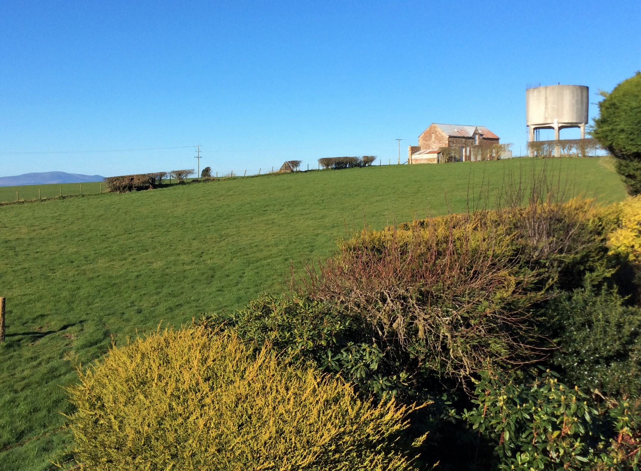
View of Beacon site and Criffel (S Pendlington)
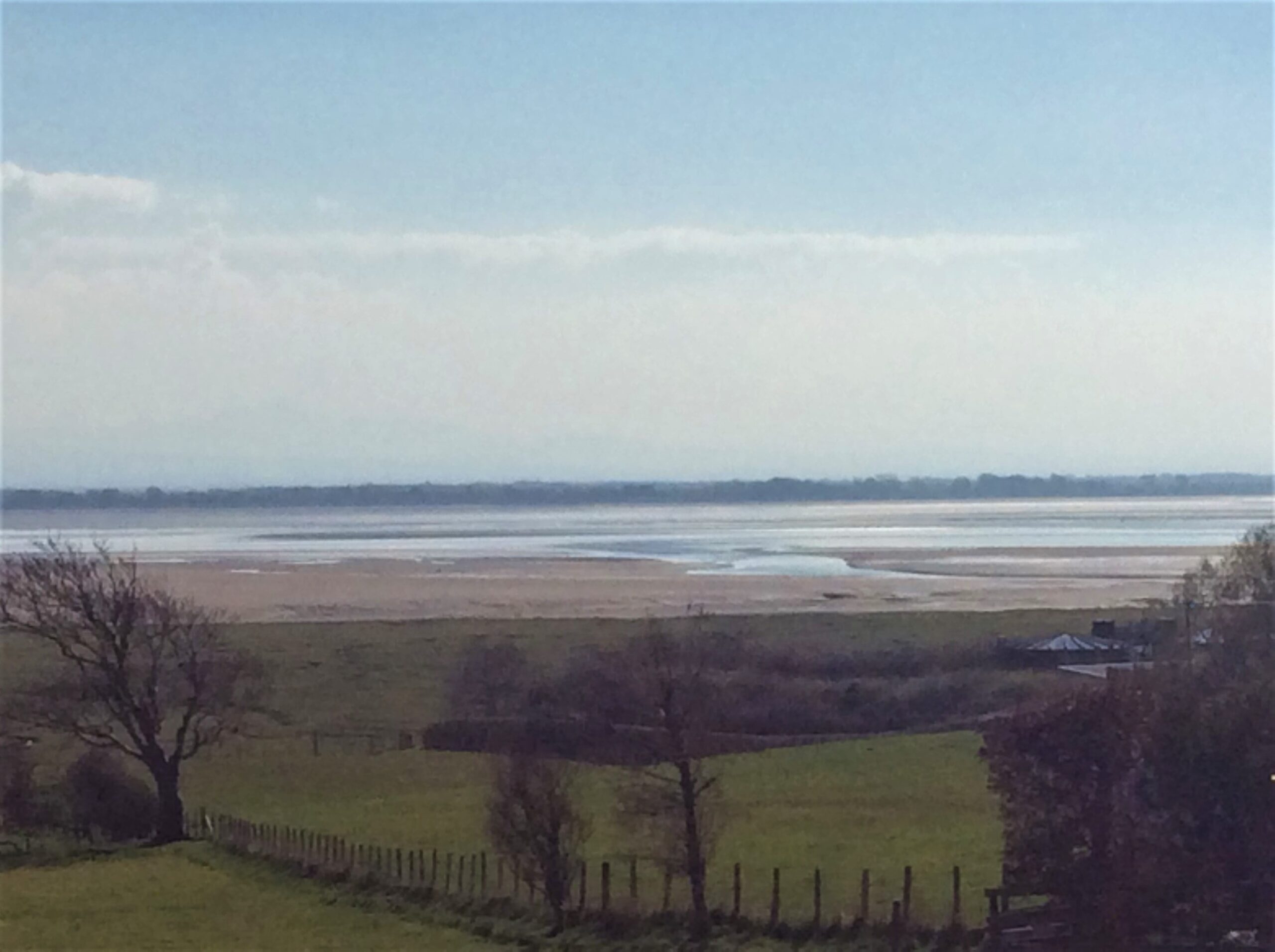
The Scottish shore at low tide (S Pendlington)
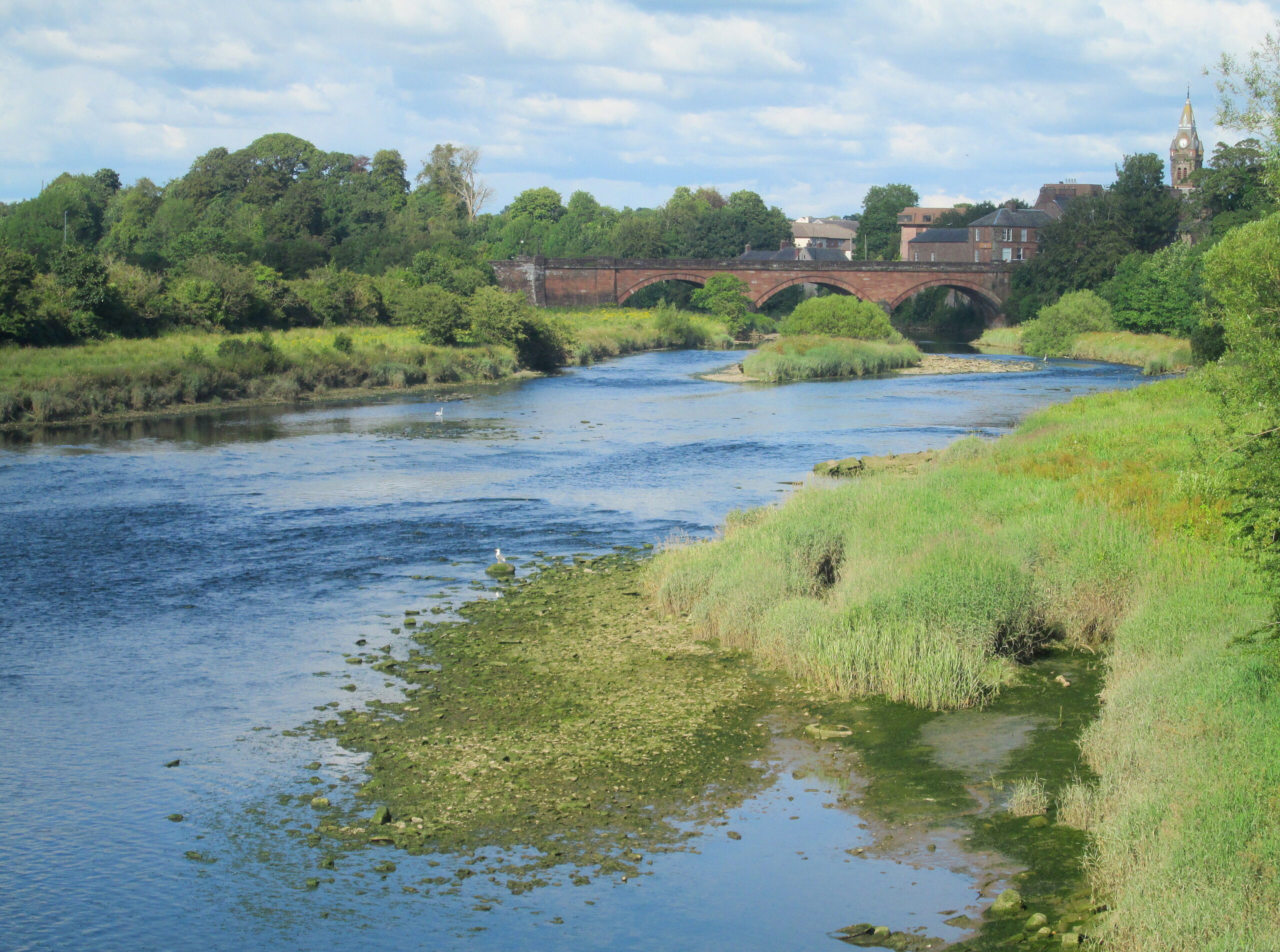
The River Annan (with permission from K Stephens)
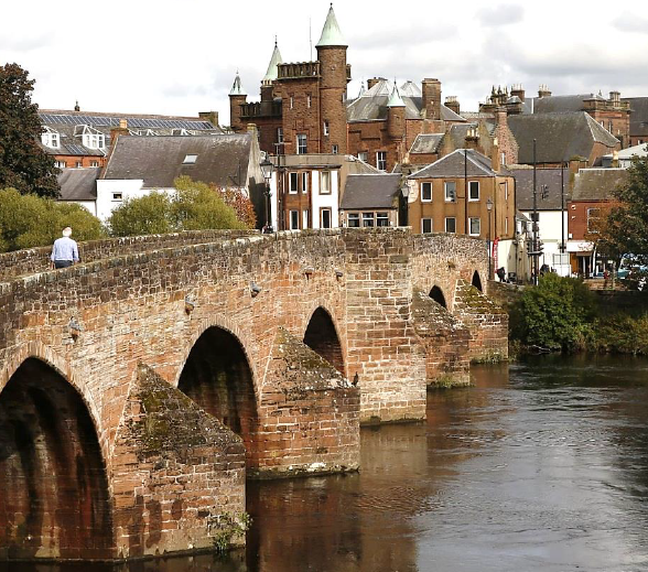
Dumfries and Devorgilla's Bridge (Guardian Newspaper)
Concluding Note
The 1482 raid on Dumfries has not been researched in detail before and the story is a fuller account than those of historians who mention the raid. The researcher is a member of the Scottish Branch of the Richard III Society who lives on Annan Hill, overlooking the Bowness Wath, and has a knowledge of the history and geography of Dumfriesshire. It is most likely to be the story of what happened.